Geolocation is a technique of identifying the geographic or physical location of a person or device with digital information using longitude and latitude mapping.
Methods used for geolocation include Global Positioning Systems (GPS), Wi-Fi positioning, Cell tower trilateration and IP address based location mapping.
Find out your IP Address and Geolocation your our public IP address and geolocation tool.
With any new technology providing convenience there are always some tradeoffs. The same is the case with the use of geolocation services. In this post, I will go over applications of geolocation data and how it is collected. I will also go over details of how where you can find geolocation data for free and with paid services.
How Geolocation Works
Geolocation information is used in a wide range of applications, from map navigation, social media, finance, health care and logistics. Many modern applications would not exist without the use of geolocation information.
As stated earlier, geolocation works by using various technologies to determine the location of a device or person.
GPS systems are one of the most common methods of geolocation. They work by using a network of satellites that orbit the Earth, each of these satellites sends RF signals to GPS receivers on the ground and flying devices. By triangulating these signals, a technique to identify a somewhat precise location, a GPS receiver can determine its current location.
The geographic or physical location of a person or device using digital information with longitude and latitude mapping.
For wireless devices, geolocation can also be obtained through Wi-Fi. This involves scanning the local area for available Wi-Fi networks and using the signal strength and location of these networks to determine the device’s location. This technique is used indoors where GPS signals may be weak or unreliable.
Cellular networks are also used in a similar manner to how GPS determines the location. When a device communicates with a cellular network, the network determines the device’s location based on the signal strength and location of nearby cell towers. At least three towers are used for this process for the geolocation determination to be correct.
With everything connected to a network, IP addresse is an additional way to determine device geolocation. By analyzing the IP address, it is possible to determine the general location of the device.
Read here about what an IP address is.
Applications of Geolocation Services
Geolocation is used in many industries in a wide range of applications. Listed below are some examples of how geolocation is used in these applications:
- Advertising, Marketing and e-Commerce: In advertising targeting customers based on their location is frequently used to identify potential customers for products and services. e-Commerce stores also use location identification services to limit serving their content only to customers in areas they serve.
- Emergency Services: Geolocation is critical in emergency services such as 911 calls. By using GPS and cellular networks, emergency responders can quickly locate a caller and dispatch assistance services. OnStar service from GM is an example of a service used for providing emergency support services utilizing location information obtained from GPS systems.
- Farming: Geolocation information is used for mapping out farm tracts. Companies like John Deere are also using geolocation with GPS in their tractors for optimization cultivation of the land.
- Logistics and Transportation: Logistics and transportation industries use GPS info to track the location of shipments and equipment. This information can be used to optimize routes, monitor delivery times, and provide real-time updates to customers.
- Healthcare: Wearable devices are sued to track and monitor vulnerable patients’ locations and provide alerts and locations to healthcare providers.
- Insurance Claim Processing: Insurance claim adjusters use geolocation technology to substantiate a policyholder’s location and minimize the number of fraudulent or exaggerated claims.
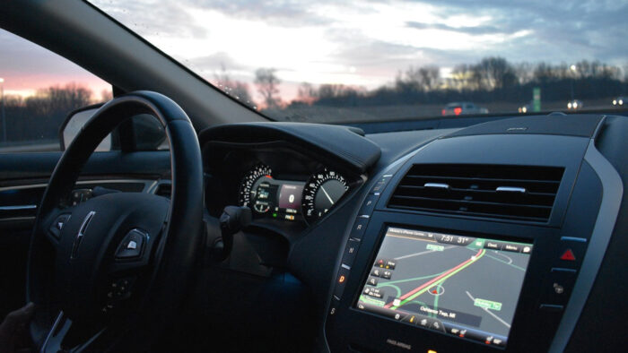
- Maps & Navigation: Mapping and navigation devices use GPS services to provide users with turn-by-turn directions to destinations.
- Public Safety: Geolocation data can be used by law enforcement and emergency responders to locate and track missing persons, monitor criminal activity, and respond to emergencies.
- Social Media and Web Application: Online platforms use geolocation to provide location-based services to their users. For example, images taken by mobile phones can include location data as part of the image metadata.
- Weather forecasting: Weather forecasting services provide local weather information and alerts, such as air quality alerts and weather warnings.
Geolocation Data Collection
Primary sources of geolocation data collection is mobile devices, such as smartphones and tablets. With built-in GPS receivers and/or Wi-Fi and cellular triangulation capabilities, they make it easy to determine a user’s exact location.
Websites and web applications, such as Facebook, Twitter and Instagram also collect geolocation data from their users allowing them to offer advanced features such as the use of location tagging in posts and images. This data is also used to enhance security experience by tracking where the user is logging from and blocking unauthorized attempts to access their accounts from risky or questionable locations.
Other types of geolocation data sources are devices such as RFID tags, IoT devices, and geotagging. These devices allow businesses to track the movement of people and assets in real-time, which is useful for inventory management, logistics, and public safety.
Following is more detailed information on channels that generate location data and collect such information.
- GPS: GPS used in most modern vehicles and mobile devices can generate a lot of real-time location data. This works by triangulating a location signal between multiple satellites and the installed GPS client device. This gives the accurate latitude and longitude coordinates for a person, device, or vehicle’s location.
- Cellular network: Similar to GPS, cellular networks geolocate a device location when the user initiates a phone call or use cellular data on the network.
- Internet: Using IP address information one can also access its location by requesting the browser or other application in use. The IP address assigned to a person corresponds to their physical location. This IP address is assigned by the Internet Service Provider (ISP) who maintains an approximate physical location.
- Geotagging: Geolocation data can be added to digital artifacts by adding location details as metadata. Some digital cameras and applications have built-in GPS hardware to detect the user’s location and add it as metadata to the photo. In case when there is no hardware in the camera, they are able to pull that information from the mobile phone of the user when connected prior to taking the photo or video.
- Maps and GIS apps: Geographic information systems and other Mapping devices are also sources of geolocation data. Many modern GIS applications allow the ability for user-generated locations to associate with a specific physical location.
- Transaction data: Information in electronic transactions can also generate useful location data which is collected and used by financial and marketing services.
Geolocation and Privacy Implications
As the use of technology increases so does the scope of applications. This raises important privacy concerns. The collection and use of personal data, including location data, is subject to privacy regulations, such as GDPR in the European Union and CCPA in California. It is important for organizations that collect and use geolocation data to obtain proper consent from users and to ensure that the data is collected and used in a responsible and ethical manner.
Following are some risks with the storage and use of location data:
- Geolocation data provides a detailed picture of a person’s movements and activities, which has significant implications in regard to privacy and security if leaked.
- Another concern with geolocation data is the potential of location tracking without a person’s knowledge or consent. There are apps collecting and using such data without disclosing it properly to their users.
- Unencrypted storage and non-secure access and transmission of personal location data can pose risks to individual safety.
It is important for individuals to be aware of the privacy implications of geolocation technology and to understand how their personal data is being used. Users can take steps to protect their privacy, such as disabling location tracking in mobile apps or using privacy settings to control the collection and use of personal data.
How Accurate is Geolocation
Environment, methodology and technology used to collect geolocation data determine the accuracy of the dataset. GPS data is generally the most accurate technology for data collection with an accuracy of around 10 meters (or less) in open areas.
However, there are other factors that may affect the accuracy of the data. Let’s look at some of them.
Factors Affecting Accuracy of Geolocation Data
- Environmental conditions: The accuracy of geolocation data can be affected by environmental conditions, such as weather, topography, and interference from other radio signals.
- Number of satellites: The number of GPS satellites used for triangulation can affect the accuracy of the geolocation data. The higher the number of satellites visible to the device more accurate will be the data.
- Quality of data collection: Errors in the data collection process, such as incorrect timestamps or inaccurate device settings, can result in inaccurate location data.
- Privacy settings: Privacy settings of a device or app may limit the type od data. Some apps anonymize the actual data to conceal user location and activities.
- Signal strength: The strength of the GPS, WiFi or other radio signals affect the accuracy of the geolocation data. The accuracy of data will be reduced in areas with weaker signals.
- Technology: The type of technology used to collect the location data can affect the accuracy of the data. GPS is generally the most accurate technology for geolocation, but other technologies, such as Wi-Fi and cellular triangulation, can also be used in certain situations.
- Type of location: The accuracy of geolocation data can vary depending on the type of location, such as indoor or outdoor. In general, GPS is less accurate indoors, where there may be obstructions to the GPS signals.
The factors listed above may limit where a specific set of data can be used. For example, for a guided cruise missile in flight must have the most accurate data, whereas a weather application may not need the exact location and can work well with data providing the approximate location.
Geolocation APIs
Geolocation APIs provide the latitude and longitude coordinates of the user’s device. Some devices and systems provide their own APIs to access location information whereas for others you may need to call an external Software as a Service (SaaS) provider API.
To access the Geolocation API on a device, web applications need to request permission from the user. Once the user grants permission, the Geolocation API uses the available location data to determine the user’s location.
For browser based applications, location API is available for use. On mobile systems, such as Android and Apple iOS you can access their respective APIs using supported languages.
In cases where you are building a custom application that relies on geolocation data and the native system does not provide such services you can use REST web services to access this data.
Types of Geolocation Data You Can Buy
Depending on how the data is used, it is categorized into the following larger categories.
- Address: Address data is the most fundamental type of geolocalized data. It is information on the physical location of something on the face of planet Earth, usually represented by latitude and longitude coordinates.
- Imagery: Imagery data consists of photos of what the physical world looks like, and is considered geolocation data when used to identify where a place or object is based on its surroundings. Geotags can also be used with imagery.
- Mobility: Mobility data refers to information that locates people based on signals from devices that are mobile, such as phones and automobiles.
- Point of interest: Point of interest (POI) data is contextual information about any place on Earth someone might want to visit. Private residences are not part of POI data.
- Property: Property data refers to information about a parcel of land and buildings on it.
- Street: Street data covers transportation networks, usually roads for land-based vehicles such as cars and trucks.
- Specialized datasets: Data on air and ocean traffic routes are examples of specialized data sets used for specialized services.
Where You Can Buy Geolocation Data
In the section above I went over platform APIs through which you can access free location data for a user. But those APIs don’t provide datasets for offline analysis.
Listed below are some vendors who provide custom datasets for analysis or for custom applications.
- IPAPI: This is a provider of IP Address to geolocation mapping. Their data is highly accurate and can be accessed through REST API from most programming languages.
- Otonomo & Wejo: Both of these vendors provide GPS data sourced from computers inside vehicles. This data includes traffic patterns, route lengths and times, and driver behavior. (Dataset: vehicle)
- RootMetrics: RootMetrics uses cellular network data from phone towers as a method of geolocating people with mobile devices. However, because potential ground-based obstacles can obscure tower signals, this data is not as precise as GPS. (Dataset: mobility)
- SafeGraph: SafeGraph has several types of geolocation data globally. Their Places dataset contains detailed information on over 40 million points of interest, while their Geometry dataset features accurate polygon building footprints. Additionally, they also have the Spend dataset, which provides anonymized and aggregated credit and debit transactions at individual points of interest throughout the US. (Dataset: point of interest, business listing, polygon, financial transaction)
- Veraset: A leading provider of geolocation data. Veraset’s Movement data consists of hundreds of billions of precise and pseudonymized GPS signals. They cover U.S. and 150 other countries, providing the largest and cleanest commercially available population movement dataset. (Dataset: property & mobility data)
- VeroRoutes: Provides the most detailed collection of real-world flight routes and en-route CPDLC simulation data.
Future of Geolocation
The future of geolocation is very exciting, with the potential for new technologies and applications to emerge in the coming years.
Following are interesting areas of use for geolocation data:
- Augmented Reality: Another area of growth is in the use of geolocation for augmented reality and virtual reality applications. Geolocation data can be used to create new apps providing immersive and interactive experiences.
- Real-time location: With the increasing availability of sensors and connected devices, there is the potential for geolocation data to be collected and analyzed in real-time. This will provide opportunities for personalized services and experiences.
- Smart cities: By using location data to optimize traffic flow, reduce congestion, and improve public services, cities can become more efficient and livable.
With all of these new applications the issues of privacy and secure access and storage of data will become more important to address. the issue of data will become more significant. There is a risk that personal data can be used for unintended purposes, such as surveillance by private and government entities.
Regulations with respect to the use of geolocation have to strike a balance between the benefits and risks these technologies will provide.
Find out how to trace geolocation from an email to get the geolocation and IP address of an email sender or spammer.
View your public IP using our free tool.